Cities / Towns in Khyber Pakhtunkhwa Pakistan
It provides an inclusive collections of beautiful pictures of Khyber Pakhtunkhwa and all of the famous and attractive visiting places there. Travel guide about Khyber Pakhtunkhwa is also available to visit various visiting places there to enjoy the best and memorable moments of your life while exploring there.
-
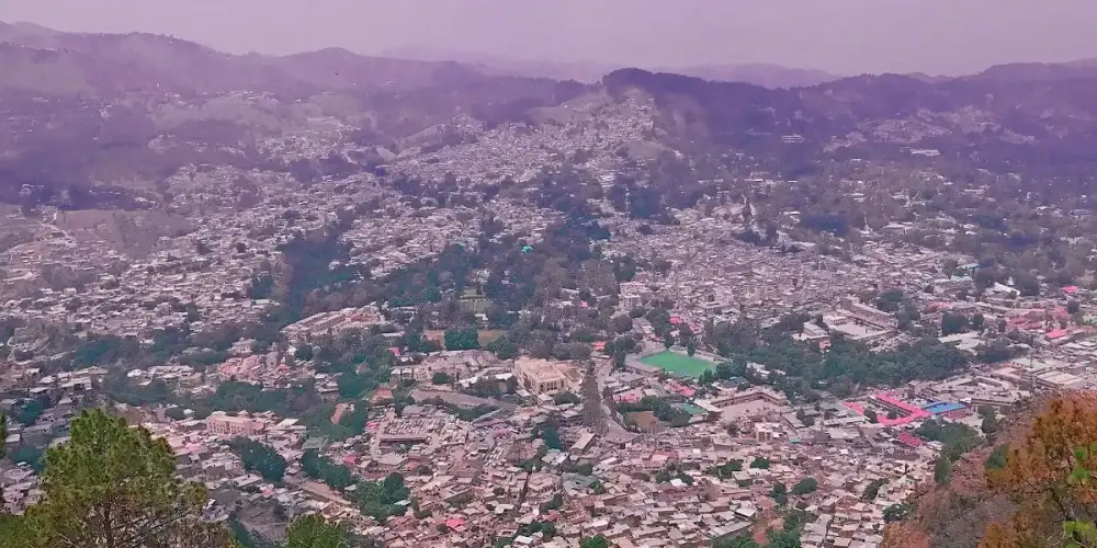
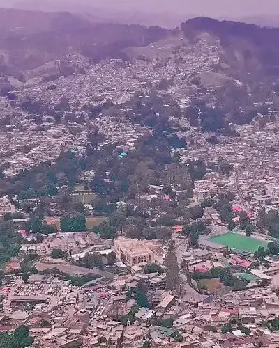
Abbottabad
Abbottabad, a gateway to Northern Areas, is situated in Hazara, Khyber Pakhtunkhwa at an elevation of 4,121 feet at a distance of 110 km from Islamabad capital of Pakistan. Abbottabad is famous for its pleasant weather due to its border with Kashmir and Murree.
Visiting Locations in Abbottabad -
Bajaur Agency
Bajaur is the smallest agency in the Federally Administered Tribal Areas, FATA. Its land structure is mostly hilly terrain. Most of the mountain ranges in Bajaur are lush green, with small streams. Its weather remains pleasant due to Swat valley in the east. It is located at the distance of 195 km from Peshawar and accessible via Malakand Mardan Road and N-45.
Visiting Locations in Bajaur Agency -
Balakot
Balakot is the most important town in the Mansehra district in Khyber Pakhtunkhwa and is located on the right bank of the Kunhar River. The Kunhar River flows in a very clam channel after crossing Balakot instead of narrow and sharp gorges in the Kaghan Valley.
Visiting Locations in Balakot -
Bannu
Bannu is situated at a distance of 198 km from Peshawar on the basin drained by the Kurram River and the Tochi River, flowing from Waziristan Hills. It has very fertile land, located on the foot of frontier hills and surrounded by rugged and dry mountains.
Visiting Locations in Bannu -
Battagram
Battagram is located in the Karakorum Range having an elevation of 3406 feet, at the distance of 291 km from Peshawar in Khyber Pakhtoonkhwa, and is accessible via Mansehra on the Karakoram Highway N-35. It is located at the lusg green deep forest area in the Karakorum Range.<
Visiting Locations in Battagram -
Buner
Buner is located at the distance of 142 km from Peshawar via Mardan and Charguli in Khyber Pakhtoonkhwa. It is a mountain valley, surrounded by mountain ranges such as Ilam Range, the Duma Range, the Guru mountains, and the Sinawar Range.
Visiting Locations in Buner -
Charsadda
Charsadda is situated at a distance of 32 km from Peshawar at an altitude of 906 feet and is accessible by Islamabad-Peshawar Motorway M1 and then following the Noshera-Charsadda Road. It is located on the left bank of the Kabul River as well as the Swat River in the middle of the district.
Visiting Locations in Charsadda -
Chitral
Chitral, a beautiful valley in the Hindukush Range, is located on the western bank of the Chitral River, in the Northwest of Pakistan at the far end border with Afghanistan. Chitral is famous for the scenic beauty of Tirich Mir, which is the highest peak in the Hindukush Range.
Visiting Locations in Chitral -
Dera Ismail Khan
Dera Ismail Khan, also known as D. I. Khan, is situated on the right bank of the Indus River at the junction of the Gomal River. It is a borderline between Khyber Pakhtoonkhwa and Punjab and is located at the distance of 300 km from Peshawar city on Indus Highway N-55 via Kohat and Bannu.
Visiting Locations in Dera Ismail Khan -
Dir
Dir is located at a distance of 213 km from Peshawar on the foothills of the Himalayas and is accessible via Chakdara by Dir-Chitral Road and then following Dir-Malakand Road. It was a princely state and ruled by Nawab Shah Jehan Khan and merged with Pakistan in 1969. It is gateway to Chitral in north and to Swat in the east. In 1996, it was divided into Upper Dir district and Lower Dir district.
Visiting Locations in Dir -
Hangu
Hangu is located at the distance of 109 km from Peshawar via Kohat on Kohat-Hangu Road. It is located next to Kohat at the distance of 30 KM. It is a beautiful town with lush green mountains and valleys. Its name is due to some expected Chinese travelers as there is town in China with same name.
Visiting Locations in Hangu -
Haripur
Haripur is situated in Hazara at the distance of 160 km from Peshawar on Karakorum Highway N35 on the bank of the Dor River, at an altitude of 2,000 feet. It was also the main city in the ancient Gandhara civilization. Mostly, it has hilly plain area with deep forest.
Visiting Locations in Haripur -
Karak
Karak is a district in Khyber Pakhtoonkhwa at the distance of 139 km from Peshawar main city on Indus Highway N-55. Its landscape is composed of barren mountains but rich with natural minerals such as oil, gas, salt and uranium, etc.
Visiting Locations in Karak -
Khyber Agency
Khyber is one of the famous agency, previously under the Federally Administered Tribal Areas (FATA), and located at the distance of 67 km from Peshawar on National Highway N-5. Khyber Pass is one the main site in khyber Agency and one of the major pass to cross border between Afghanistan and Pakistan.
Visiting Locations in Khyber Agency -
Kohat
Kohat is located on the right bank of the Indus River at the distance of 72 KM from Peshawar on Indus Highway N-55 after crossing Kohat Pass. It is located at an altitude of 489 metres from the sea level. In the British Regime, there were a number of military cantonments in the city, so it was an important strategic city for the British.
Visiting Locations in Kohat -
Kohistan
Kohistan is an administrative region and covering an area around the Indus River next to Battagram on Karakoram Highway in the Hazara region in Khyber Pakhtoonkhwa. It is located at a distance of 421 km from Peshawar to its head quarter Dasu. It is the main connecting point with Gilgit-Baltistan via Karakoram Highway.
Visiting Locations in Kohistan -
Kurram Agency
Kurram Agency is located at the distance of 218 km from Peshawar and accessible via Thall-Hangu Road. Its name is derived from the Kurram River, that flows across this valley, which enters in Pakistan from Afghanistan and finally merges with the Indus River near Isa Khel.
Visiting Locations in Kurram Agency -
Lakki Marwat
Lakki Marwat is situated at a distance of 217 km from Peshawar city. Its landscape is mixture of hills and sandy plains. These hills having the average elevation of 500 to 1000 meters. The Marwat range, the Kark Niazi range, and the Baittani range spread around the city. The Kurram River and the Gambila River are the main rivers flows across the district.
Visiting Locations in Lakki Marwat -
Malakand
Malakand is located at a distance of 86 km from Peshawar via Mardan on Malankand-Mardan Road. It has very important strategic location as a gateway to Bajaur, Swat, Buner, and Lower Dir. It is surrounded by barren mountains, where Malakand Pass connects Mardan to Swat and to Dir near Dargai.
Visiting Locations in Malakand -
Mansehra
Mansehra is located at the distance of 221 km from Peshawar on Karakoram Highwary N-35. It is very important location as a gateway to Gilgit-Baltistan through Karakoram Highway or through Babusar Pass in the Kaghan Valley. It has very pleasant weather due to surrounding valleys such as Kaghan and Kashmir.
Visiting Locations in Mansehra
About Khyber Pakhtunkhwa
Khyber Pakhtunkhwa it the third largest province by population in the northwest of Pakistan. It has well defined history of Hinduism and Buddhism, it was once a part of Gandhara Kingdom, the ruins of its capital Pushkalavati found near Charsadda.
Khyber Pass is an historical pass in the Hindu Kush Range and was merchants route in the Indus Valley Civilization in 3300 BC. Still this Khyber Pass is used as a trade route between Pakistan and Afghanistan. In Mughal Regime, this area was partially under the control of Pashtun Emperor, Sher Shah Suri and some other tribes.
Khyber Paktunkhwa is located on Iranian Plateau and is composed the junction where the Hindu Kush range slopes on the Eurasian Plate, to create a way to the Indus Water. The northern side is normally cold and snowy in winters and pleasant in summers, whereas southern part is arid and hot in summers and cold and rainy in winters. This area stretches from the Sulaiman Mountains to the Indus River.
There are number of beautiful valleys in Khyber Pakhtunkhwa such as Swat, Chitral, Kaghan, Abbottabad, etc, which are well known attraction for tourist in this province.