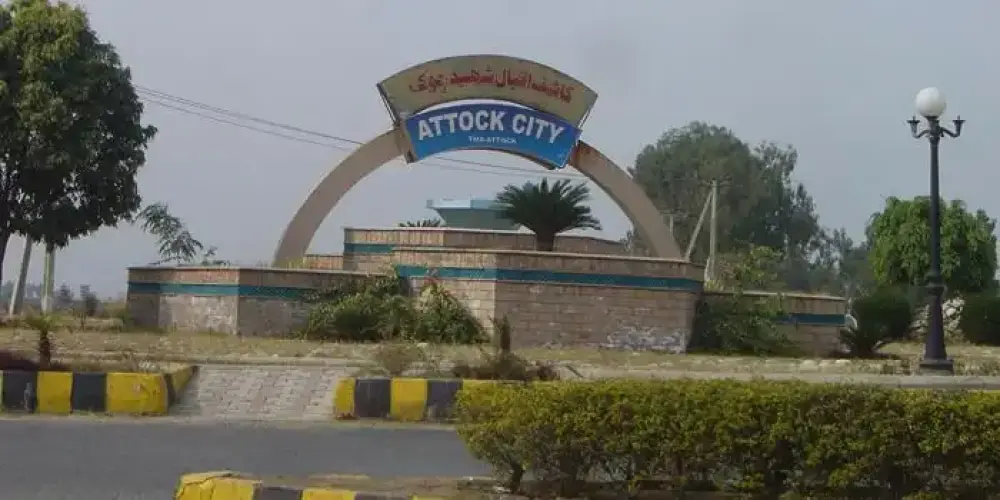
Major cities and towns in Pakistan

Gujranwala

Click to Zoom..
Click to Zoom..

Gujranwala is the third-largest industrial city of Pakistan at a distance of 96 km from Lahore on G. T. Road. It is also known as the city of wrestlers as well as the city of food lovers. It is the fifth most populous city in Pakistan. It is also known as the Golden Triangle of industrial cities, as it plays a major role in the exports of Pakistan.

Guide about Gujranwala Locations in of Kohala

Gujrat

Click to Zoom..
Click to Zoom..

Gujrat is an industrial and historical city located between the Jhelum and Chenab rivers, at a distance of 140 km from Lahore on G. T. Road. It was a planned city in sub-continent. It is also known as the Golden Triangle of industrial cities, as it plays a major role in the exports of Pakistan. Three cities Gujrat, Gujranwala, and Sialkot are the part of this Golden Triangle. Due to Gujjar tribes were settled there, the town is called Gujrat.

Guide about Gujrat Locations in of Kohala

Jhang

Click to Zoom..
Click to Zoom..

Jhang is located at the confluence of the Chenab river and the Jhelum river at Trimmu Barrage, on the east bank of the Chenab river. It is accessible from Faisalabad at the distance of 76 km via Jhang Faisalabad Road, otherwise turn right from Lahore-Karachi National Highway - N5 from Chichawatni via Toba Tek Singh at the distance of 90 km.

Guide about Jhang Locations in of Kohala

Khushab

Click to Zoom..
Click to Zoom..

Khushab, meaning sweet water, is situated near the Jhelum River in Punjab at the distance of 250 km from Lahore, next to Sargodha on Islamabad-Lahore Motorway M-2, on the left from Bhularwan interchange via Bhalwal or from Sial Interchange on Lahore-Sargodha Road, National Highway N-60 at the distance of 232 km from Lahore.

Guide about Khushab Locations in of Kohala

Lahore

Click to Zoom..
Click to Zoom..

Lahore, the capital city of Punjab, is the most populous and second-largest city in the northeast part of Punjab province in Pakistan on the border with India at Wagah. It is located on the bank of River Ravi at a height of 213 meters above sea level. It is linked with the rest of Pakistan and accessed by all types of transportation. It is the major city to access all of the cities and towns of Punjab province. It has the largest railway station in Pakistan. Allama Iqbal International airport is used for all types of international and local flights.

Guide about Lahore Locations in of Kohala

Multan

Click to Zoom..
Click to Zoom..

Multan, the premier center of southern Punjab, is located on the banks of the Chenab River at the distance of 338 km from Lahore. It is accessed via Abdul Hakeem Motorway M-3 as well as National Highway N-5. Multan is the fifth largest populous city of Pakistan. Multan is also known as cultural center in the province Punjab. Multan is also known as city of saints due to number of shrines of Sufi saints.

Guide about Multan Locations in of Kohala

Murree

Click to Zoom..
Click to Zoom..

Murree, an ideal and modern hill station, is situated on the Pir Panjal Range in Punjab at an altitude of 7,516 feet above sea level. It is located at a distance of 72 km from Rawalpindi through Islamabad-Murree Expressway - N75 and can be accessed easily from Rawalpindi and Muzzafarabad. It is the most famous and modern hill station in Pakistan.

Guide about Murree Locations in of Kohala

Sargodha

Click to Zoom..
Click to Zoom..

Sargodha is located at a distance of 172 km in the northwest of Lahore between the Chenab River and the Jhelum River on the left side on the Islamabad-Lahore Motorway M-2 after Pindi Bhattian, on Lahore-Sargodha Road N-60. It is an important air base of Pakistan Air Force (PAF) and also famous for high quality world-class juicy oranges.

Guide about Sargodha Locations in of Kohala

Sheikhupura

Click to Zoom..
Click to Zoom..

Sheikhupura, also called The Rice Valley, is an industrial city at the distance of 38 Km from Lahore on the northwest side in Punjab on the old G. T. Road. Its old name was Jahangirpura developed by the Mughal Emperor Jahangir in 1607, as it was a major area to stay at the time of the Mughal Empire while visiting the military headquarters in Lahore Fort.

Guide about Sheikhupura Locations in of Kohala

Karachi

Click to Zoom..
Click to Zoom..

Karachi, the capital of Sindh, the most populous city of Pakistan and is also the largest city by area in Pakistan. It lies on the shore of the Arabian Sea and on the western edge of the Indus River. It is the main business and financial hub of Pakistan having the head offices of all major industries and major banks in Pakistan.

Guide about Karachi Locations in of Kohala

Sanghar

Click to Zoom..
Click to Zoom..

Sanghar is situated at a distance of 302 km from Karachi and accessible via Hyderabad on National Highway N-120. It is one of the largest districts of Sindh Province and has a boundary with India. There are some historical places such as the tomb of Mir Shahdad Talpur in Shahpur Chakar and Mansura, rains of the seventh century

Guide about Sanghar Locations in of Kohala

Sujawal

Click to Zoom..
Click to Zoom..

Sujawal is situated on the left bank of the Indus River at the distance of 130 km from Karachi and is accessible via Thatta on Sujawal-Thatta Road. South side is the part of the Indus Delta as well as the Arabian Sea. The Indus Delta on the left side of the Indus River toward the India-Pakistan border is the main part of the district.

Guide about Sujawal Locations in of Kohala

Sukkur

Click to Zoom..
Click to Zoom..

Sukkur is situated in Sindh Province on the left bank of the Indus River at a distance 489 km from Karachi on National Highway N-5. It is considered as the Gate of Sindh. It is an important railway junction in Pakistan Railway as well as in the British time. Sukkur is also famous for one of the largest military cantonments of Pakistan Army in the town of Pano Aqil.

Guide about Sukkur Locations in of Kohala

Dir

Click to Zoom..
Click to Zoom..

Dir is located at a distance of 213 km from Peshawar on the foothills of the Himalayas and is accessible via Chakdara by Dir-Chitral Road and then following Dir-Malakand Road. It was a princely state and ruled by Nawab Shah Jehan Khan and merged with Pakistan in 1969. It is gateway to Chitral in north and to Swat in the east. In 1996, it was divided into Upper Dir district and Lower Dir district.

Guide about Dir Locations in of Kohala

Kohat

Click to Zoom..
Click to Zoom..

Kohat is located on the right bank of the Indus River at the distance of 72 KM from Peshawar on Indus Highway N-55 after crossing Kohat Pass. It is located at an altitude of 489 metres from the sea level. In the British Regime, there were a number of military cantonments in the city, so it was an important strategic city for the British.

Guide about Kohat Locations in of Kohala

Swat

Click to Zoom..
Click to Zoom..

The lush-green and bow-shaped valley of Swat is famous tourist place due to its shining waterfalls, singing Swat River and its tributaries, and fruit-laden orchards, and gardens with a stack of colorful flowers. Swat is an ideal for holiday-makers loving for relaxation after their busy lives to explore various swat valley tourist places. It is located in the range of Hindukush Range at an altitude of 976 meters above sea level.

Guide about Swat Locations in of Kohala

Torghar

Click to Zoom..
Click to Zoom..

Torghar, also known as Kala Dhaka, is the smallest district of Pakistan in Khyber Pakhtoonkhwa. It is situated along the left bank of the Indus River, the area is also known as the Black Mountain. The Black Mountain with high peaks at intervals, forms a long narrow ridge and deep passes along the Indus River. The highest peak is known as Machai Sar, which is visible from adjoining areas.

Guide about Torghar Locations in of Kohala

Jafarabad

Click to Zoom..
Click to Zoom..

Jafarabad, or Jaffarabad, is located on the border of Sindh province at the distance of 290 km from Quetta city and is accessible via sibi on Quetta-Jacobabad Highway. Its name is derived after Mir Jaffar Khan Jamali, who was a leader in Muslim League before independence of Pakistan and also a close friend of Quaid-e-Azam, founder of Pakistan.

Guide about Jafarabad Locations in of Kohala

Kohlu

Click to Zoom..
Click to Zoom..

Kahlu is a district in Balochistan Province at a distance of 350 km from Quetta. It is accessible by Ziarat Road via Ziarat district and following Duki Road which further joins Kohlu-Sibi Road that leads to Kohlu. There are numerous barren and desert like ranges of the Sulaiman Mountain Range in the district.

Guide about Kohlu Locations in of Kohala

Nushki

Click to Zoom..
Click to Zoom..

Nushki is a district in Balochistan Province at the distance of 144 km from Quetta, on the bank of the Kaisar Rud, on Quetta-Taftan Highway N-40. It is situated on the plains of the Quetta Plateau, which has elevation of 2,900 feet, and the flat Balochistan desert stretches away westward and northward to the Helmand River in Afghanistan.

Guide about Nushki Locations in of Kohala

Ziarat

Click to Zoom..
Click to Zoom..

Ziarat is located in Balochistan at the distance of 130 km from Quetta. It is a beautiful hill station in Balochistan surrounding by mountains that receive heavy snowfall in winter, which makes it more attractive and charming. Khalifat Hill is the highest peak at an elevation of 11,400 feet in the Ziarat district. The importance of this city is due to Quid-e-Azam Residency. Quid-e-Azam, founder of Pakistan.

Guide about Ziarat Locations in of Kohala

Astore

Click to Zoom..
Click to Zoom..

Astore is district in the Gilgit-Baltistan and located at an altitude of 8,500 feet on the eastern side of Mount Nanga Parbat, at the distance of 60 km from Gilgit main city. Astore region ascends from the Indus River from Jaglot in Diamer district. The valley is famous for different kinds of important medicinal plants and herbs. In summer, the colors of the valley become very much attractive due to various kinds of colorful flowers.

Guide about Astore Locations in of Kohala

Diamer

Click to Zoom..
Click to Zoom..

Diamer is the district of Gilgit-Baltistan on the Karakoram Highway along the Indus River. It is the gateway to access the mighty mountains of Karakoram Range in Gilgit-Baltistan from Khyber Pakhtoonkhwa province. The Chilas is the capital town of the Diamer district. One of the major importance of this city is the Nanga Parbat, which is the 9th highest mountain in the world, having a height of 8,126 meters.

Guide about Diamer Locations in of Kohala

Ghanche

Click to Zoom..
Click to Zoom..

Ghanche is the easternmost part of Gilgit-Baltistan and is situated on the banks of the Shyok River, at a distance of 306 km from Gilgit city via Skardu. It is the coldest place in Pakistan and is also known as the Third Pole with temperatures reaching below -20 centigrade. Its name is derived from a seasonal stream, called Ghanche Nallah.

Guide about Ghanche Locations in of Kohala

Nagar

Click to Zoom..
Click to Zoom..

Nagar district is located next to the Gilgit district in Gilgit Baltistan at an altitude of 8,822 feet on the Karakoram Highway. It was part of the Nagar-Hunza district, it is constituted as a separate district in July 2015. Nagar Khas is the major town and administrative headquarter of the Nagar district.

Guide about Nagar Locations in of Kohala

Shigar

Click to Zoom..
Click to Zoom..

Shigar is a district on the banks of the Shigar River near Skardu in Gilgit Baltistan at a distance of 239 km from Gilgit city via Skardu. There number of beautiful valleys and adventurous treks, which attract a number of visitors from all over the world. It is the gateway to the mighty mountain range of the Karakoram, in which K2, the second highest peak in the world, is the most important.

Guide about Shigar Locations in of Kohala

Bagh

Click to Zoom..
Click to Zoom..

Bagh is a mountainous and lush green area of Azad Kashmir in the Himalayas and Pir Panjal Range at an average elevation of between 1,500 to 2,500 meters above sea level. It is located at the distance of 88km from Muzaffarabad via Sudhan Gali on Sudhan Gali Road along the Mahl River with number of rivulets. These mountains are covered with coniferous forests. It was part of Poonch district before 1988, when it was given a status of district.

Guide about Bagh Locations in of Kohala

Hattian Bala

Click to Zoom..
Click to Zoom..

Hattian Bala was part of the Baramula district before the ceasefire between India and Pakistan. Then it was part of the Muzaffarabad district. In July 2009, it had got status of district. It is located at the distance of 40 km from Muzaffarabad on the bank of the Jhelum River. It is also part of Jhelum valley that is collection of valleys and mountain ranges around the Jhelum River in Azad Kashmir.

Guide about Hattian Bala Locations in of Kohala

Mirpur

Click to Zoom..
Click to Zoom..

Mirpur, the largest city of Azad Kashmir and also known for its modern bungalows and buildings, is located at a distance of 218 km from Lahore. It is also known as New Mirpur City. Mirpur is mainly an agricultural city, and is famous for millet, maize, and good quality rice of Khari Sharif. Most of its local people migrated to England, so it is also known as Little England.

Guide about Mirpur Locations in of Kohala

Neelum Valley

Click to Zoom..
Click to Zoom..

Neelum Valley, a bow-shaped thickly forested region, is the last district of Azad Jammu and Kashmir in Pakistan, located at the distance of 100km from Muzzafarabad at an altitude of 5,299 feet. Its name is due to the Neelum River, flowing across the valley. Valley is divided among Pakistan and Indian held Kashmir, the LOC is normally moved along the Neelum River in this valley.

Guide about Neelum Valley Locations in of Kohala

Rawalakot

Click to Zoom..
Click to Zoom..

Rawalakot, known as Pearl Valley, is located in Azad Jammu and Kashmir in the Pir Panjal Range at the elevation of 5,374 feet having a distance of 120 km from Rawalpindi via Kahuta on the Rawalakot Road. It is also accessible from Abbottabad by Sudhan Gali Road, then turns right on the Bagh Highway, and finally move on Rawalakot Road at Arja.

Guide about Rawalakot Locations in of Kohala