10 Best Hilly Areas in Pakistan for 2026
For summer 2026, most of the tourist have already planned to visit these trending and best hilly areas in Pakistan to have an adventurous tour. These are the hot tourist points for the year 2026, as thousands of queries have already processed to provide information about these hilly areas of Pakistan.
Here, you are provided a list of beautiful hilly areas in Pakistan to make your adventurous and unforgettable tour in the year of 2026. List is created on the basis of last three years data using tourist reviews and logistics available there. It is created after analyzing various factors such as number of visitors, tourist attractions for that hilly area, trekking difficulties, available facilities & logistics, and accessibility. These hilly areas in Pakistan will be the place of your dreams where you must go to spend few days and enjoy the best time of your life and do memorable adventure available there.
Information provided in this list is sometimes biased toward the analyst's personal interests, so it would not be necessary to match with your demand for traveling in a particular hilly area. There will be no liability on the organization, if there are some errors in providing this comparison information about hilly areas in Pakistan.
Passu
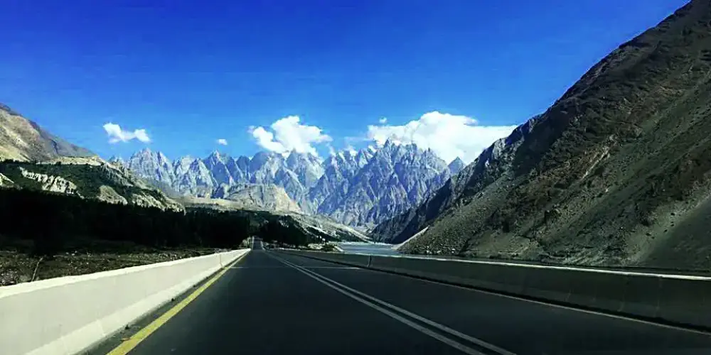
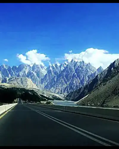
Passu is a small village located on the Hunza River at an elevation of 8,117 feet at the distance of 150 km from Gilgit on the Karakoram Highway. It is one of the beautiful valley of Gojal Upper Hunza and famous for the magnificent and panoramic view of Passu Cones from the KKH.
Province: Gilgit Baltistan
Elevation: 8,117 ft from sea level
Best Visit Time: From April to December
Shimshal
Shimshal is a largest village located in Hunza district in Gilgit-Baltistan on Pakistan China Border. It is the highest settlement in the Hunza district at the altitude of 10,170 feet above the sea level, and located at 210 KM from Gilgit City.
Province: Gilgit Baltistan
Elevation: 10,170 ft from sea level
Best Visit Time: From May to September
Minimarg
Minimarg is a very attractive village on an elevation of 2,845 meters in the Neelum Valley on the right bank of the Kishenganga River, also known as Neelum River. Geographically, it is located in Azad Kashmir, but it is mostly accessible from Astore Gilgit-Baltisan.
Province: Gilgit Baltistan
Elevation: 9,334 ft from sea level
Best Visit Time: From June to October
Soon Valley
The Soon Valley is one of the beautiful valleys in the Punjab Province in the Salt Range and can be accessed through Khushab-Mianwali road via the Khushab district at a distance of 288 km from Lahore. It can also be accessed via Kaller Kahar on Islamabad-Lahore Motorway M2.
Read Complete Soon Valley Travel GuideGojal Upper Hunza
Gojal is the largest city in Baltistan next to Hunza, having a border with China and Afghanistan. It connects with China through the Khunjerab Pass and with Afghanistan through the Chapursan Valley. Gojal, also known as Upper Hunza, is the highest mountains area in the Karakoram and Pamir mountain ranges, at an average elevation of 4,000 meters.
Province: Gilgit Baltistan
Elevation: 4,000 meters from sea level
Best Visit Time: From May to October
Kumrat Valley
Kumrat valley is located at the distance of 302 km from Peshawar in the Upper Dir, Khyber Pakhtunkhwa. It is accessible through Dir Road via National Highway N-45. It is an attractive place for tourists with full of picturesque places to visit.
Province: Khyber Pakhtunkhwa
Best Visit Time:
Chilas
Chilas is the capital town of Diamer district on the Karakoram Highway on the left side of the Indus River at the foot of Nanga Parbat. It is located at an elevation of 3,000 feet above sea level at a distance of 471 km from Islamabad via Besham through KKH and Hazara Motorway M-15. It is also accessible via Naran, Kaghan Valley, in less time by crossing Babusar Top.
Province: Gilgit Baltistan
Elevation: 4,150 ft from sea level
Best Visit Time:
Ishkoman
Ishkoman valley is located in Ghizer district, Gilgit Baltistan, Pakistan, at a distance of 140 km from Gilgit City. It will be accessed on the right of Gahkuch along the Karamber River on Karambar River Valley Road. It is a high mountain valley surrounding by snow-capped peaks at an altitude from 7,000 to 12,000 feet in the Hindukush and Karakorum Range. The highest peak near Ishkoman is Shiniki peak, which can be visible from Ishkoman valley.
Read Complete Ishkoman Travel GuideKohistan
Kohistan is an administrative region and covering an area around the Indus River next to Battagram on Karakoram Highway in the Hazara region in Khyber Pakhtoonkhwa. It is located at a distance of 421 km from Peshawar to its head quarter Dasu. It is the main connecting point with Gilgit-Baltistan via Karakoram Highway.
Read Complete Kohistan Travel GuideMalakand
Malakand is located at a distance of 86 km from Peshawar via Mardan on Malankand-Mardan Road. It has very important strategic location as a gateway to Bajaur, Swat, Buner, and Lower Dir. It is surrounded by barren mountains, where Malakand Pass connects Mardan to Swat and to Dir near Dargai.
Read Complete Malakand Travel GuideHow to process tourist visa for Pakistan using online e-Visa portal from any country, check out our Tourist Visa Guideline.