10 Best Mountainous Valleys in Pakistan for 2026
For summer 2026, most of the tourist have already planned to visit these trending and best mountainous valley in Pakistan to have an adventurous tour. These are the hot tourist points for the year 2026, as thousands of queries have already processed to provide information about these mountainous valley of Pakistan.
Here, you are provided a list of beautiful mountainous valley in Pakistan to make your adventurous and unforgettable tour in the year of 2026. List is created on the basis of last three years data using tourist reviews and logistics available there. It is created after analyzing various factors such as number of visitors, tourist attractions for that hilly area, trekking difficulties, available facilities & logistics, and accessibility. These mountainous valleys in Pakistan will be the place of your dreams where you must go to spend few days and enjoy the best time of your life and do memorable adventure available there.
Information provided in this list is sometimes biased toward the analyst's personal interests, so it would not be necessary to match with your demand for traveling in a particular mountainous valley. There will be no liability on the organization, if there are some errors in providing this comparison information about mountainous valleys in Pakistan.
Astore
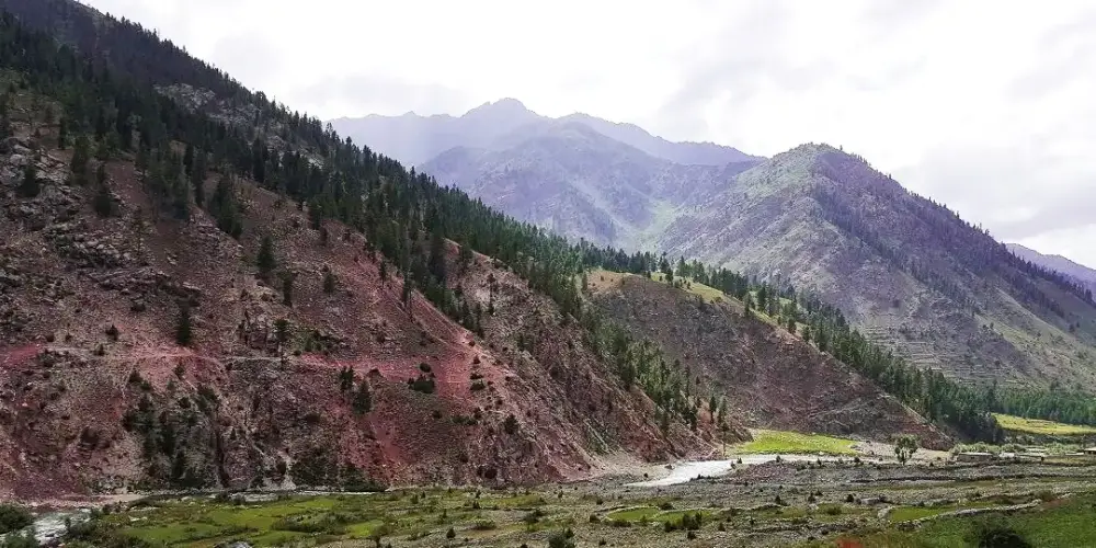
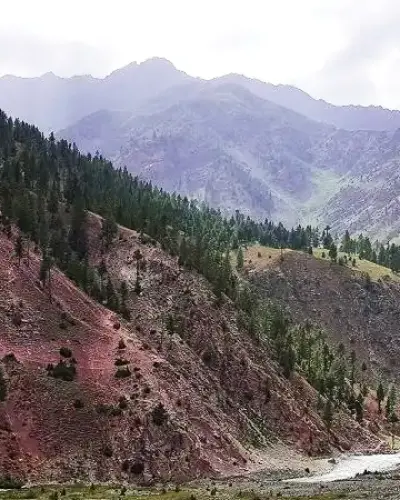
Astore is district in the Gilgit-Baltistan and located at an altitude of 8,500 feet on the eastern side of Mount Nanga Parbat in front of the Rupal Face, at the distance of 60 km from Gilgit main city. Astore region ascends from the Indus River from Jaglot toward the opposite side of the Diamer district.
Province: Gilgit Baltistan
Elevation: 8,500 ft from sea level
Best Visit Time: From May to October
Neelum Valley
Neelum Valley, a bow-shaped thickly forested region, is the last district of Azad Jammu and Kashmir in Pakistan, located at the distance of 100km from Muzzafarabad at an altitude of 5,299 feet. Its name is due to the Neelum River, flowing across the valley. Valley is divided among Pakistan and Indian held Kashmir, the LOC is normally moved along the Neelum River in this valley.
Province: Azad Kashmir
Elevation: 5,299 ft from sea level
Best Visit Time:
Shigar
Shigar is a district on the banks of the Shigar River near Skardu at a distance of 239 km from Gilgit city via Skardu. There are several beautiful valleys and adventurous treks, which attract thousands of visitors from all over the world. It is the gateway to K2, the second highest peak in the world in the Karakoram Mountain Range.
Province: Gilgit Baltistan
Elevation: 7510 from sea level
Best Visit Time: From May to September
Ghizer
Ghizer district is located along the Gilgit River on the west of the Gilgit River. It is the most beautiful and attractive valley in Gilgit-Baltistan. It has a number of colorful valleys with singing streams within the green fields. It is the gateway to Chitral from the Gilgit side via Shandur Pass.
Province: Gilgit Baltistan
Elevation: 9,940 ft from sea level
Best Visit Time: From May to September
Ghanche
Ghanche is the easternmost part of Gilgit-Baltistan and is situated on the banks of the Shyok River, at a distance of 306 km from Gilgit city via Skardu. It is the coldest place in Pakistan and is also known as the Third Pole with temperatures reaching below -20 centigrade. Its name is derived from a seasonal stream, called Ghanche Nallah.
Province: Gilgit Baltistan
Elevation: Average 9,721 ft from sea level
Best Visit Time: May to September
Gupis Yasin
Gupis Yasin is located in the west of Gilgit-Baltistan in the high mountains at an elevation of 7,139 feet in the Hindu Kush Range at a distance of 187 KM from the Gilgit main city. It is given the status of district in 2019 and separated from Ghizer district including Gupis, Yasin, and Phander.
Province: Gilgit Baltistan
Elevation: Average 7130 ft from sea level
Best Visit Time:
Kharmang
Kharmang is a district in Gilgit-Baltistan at a distance of 311 km from Gilgit City on the banks of the Indus River along Kargil-Skardu Road. It is located on the Control Line between Pakistan and India, with Kargil district of Indian-Occupied Jumma & Kashmir.
Province: Gilgit Baltistan
Best Visit Time: From May to September
Chakwal
Chakwal is located in the Dhanni region in Potohar Plateau at the distance of 90 km from Islamabad, and accessed from Lahore - Islamabad Motorway M-2 near Kallar Kahar. It is also known as land of army people as number of locals are serving in armed forces.
Read Complete Chakwal Travel GuideQuetta
Quetta, also known as the fruit garden of Pakistan, is the capital of Balochistan province, located at a distance of 691 km from Karachi. There is a number of fruit orchards in and around the city, and there are large and different varieties of fruits and dry fruits produced there.
Read Complete Quetta Travel GuideDarel
Darel district is located along the Darel River at a distance of 443 KM from Islamabad and 226 KM from Gilgit city. It was created in the Diamer district in 2019. It includes all of the valleys along the Darel River. The Darel River is a tributary of the Indus River.
Province: Gilgit Baltistan
Elevation: 7,200 ft from sea level
Best Visit Time: From May to October
How to process tourist visa for Pakistan using online e-Visa portal from any country, check out our Tourist Visa Guideline.