Beautiful Mountaineous valleys in Pakistan
Hilly areas is normally composed of number of famous and World's highest mountains. Due to varying height above the sea level, the weather and temperature normally varies in these mountains and hilly areas, as well as the landscape and structure of the hilly area depicts variety of beautiful views that would never be forgotten from your memory. Some of these hilly areas also receive snowfall in winter season which attract number of visitors from all over the World.
Hilly areas which received snowfall in winter are normally known as hill station and there are famous hill stations in Pakistan which attract tourists from all over the World. Weather conditions of these hill stations are normally pleasant in the summer season. These are the most frequent tour places specially for family tours.
Here, you may explore an inclusive collections of beautiful pictures of Mountaineous valleys in Pakistan.
Main Categories
Main Category: Hilly Areas

-
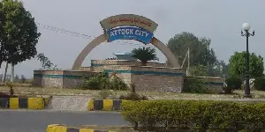
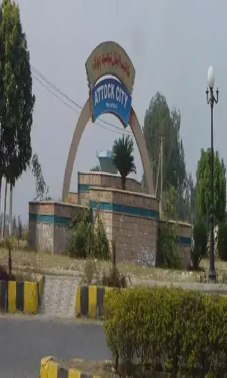
Attock
Attock is located on the bank of the River Indus on the Pothohar Plateau, at the distance of 80 km from Rawalpindi and 100 km from Peshawar. Attock is famous for the magnificent view of the merger of the River Indus and Kabul River that is visible from the bridge over the River Indus on Grand Trunk Road.
Visiting Locations in Attock -
Bajaur Agency
Bajaur is the smallest agency in the Federally Administered Tribal Areas, FATA. Its land structure is mostly hilly terrain. Most of the mountain ranges in Bajaur are lush green, with small streams. Its weather remains pleasant due to Swat valley in the east. It is located at the distance of 195 km from Peshawar and accessible via Malakand Mardan Road and N-45.
Visiting Locations in Bajaur Agency -
Balochistan
Balochistan is the largest province by area and located in the southwest side of Pakistan. Balochistan has the least number of popluation but has its importance due to vast mineral resouces including oil and gas. The natural gas resouces are the second largest resouces in the World. Another development in Balochistan is the deep sea port in Gwadar, which will be main transit point for international trade between China and rest of the World.
Visiting Locations in Balochistan -
Bannu
Bannu is situated at a distance of 198 km from Peshawar on the basin drained by the Kurram River and the Tochi River, flowing from Waziristan Hills. It has very fertile land, located on the foot of frontier hills and surrounded by rugged and dry mountains.
Visiting Locations in Bannu -
Battagram
Battagram is located in the Karakorum Range having an elevation of 3406 feet, at the distance of 291 km from Peshawar in Khyber Pakhtoonkhwa, and is accessible via Mansehra on the Karakoram Highway N-35. It is located at the lusg green deep forest area in the Karakorum Range.<
Visiting Locations in Battagram -
Bhimber
Bhimber, also known as Baab-e-Kashmir, is situated at the distance of 50 km from Mirpur on the border between Kashmir and Punjab. It was historically on the location on the route that was followed by the Mughals to visit the Kashmir Valley. It was got the status of district in 1996.
Visiting Locations in Bhimber -
Buner
Buner is located at the distance of 142 km from Peshawar via Mardan and Charguli in Khyber Pakhtoonkhwa. It is a mountain valley, surrounded by mountain ranges such as Ilam Range, the Duma Range, the Guru mountains, and the Sinawar Range.
Visiting Locations in Buner -
Chagai
Chagai is the largest district of Pakistan and is situated on the north west part of Balochistan, at the distance of 560 km from Quetta city on the Quetta-Taftan Highway N-40. The importance of this district is due to international border between Iran and Pakistan at Taftan to link with Zahedan city in Iran.
Visiting Locations in Chagai -
Chakwal
Chakwal is located in the Dhanni region in Potohar Plateau at the distance of 90 km from Islamabad, and accessed from Lahore - Islamabad Motorway M-2 near Kallar Kahar. It is also known as land of army people as number of locals are serving in armed forces.
Visiting Locations in Chakwal -
Chilas
Chilas is the capital town of Diamer district on the Karakoram Highway on the left side of the Indus River at the foot of Nanga Parbat. It is located at an elevation of 3,000 feet above sea level at a distance of 471 km from Islamabad via Besham through KKH and Hazara Motorway M-15. It is also accessible via Naran, Kaghan Valley, in less time by crossing Babusar Top.
Visiting Locations in Chilas -
Darel
Darel district is located along the Darel River at a distance of 443 KM from Islamabad and 226 KM from Gilgit city. It was created in the Diamer district in 2019. It includes all of the valleys along the Darel River. The Darel River is a tributary of the Indus River.
Visiting Locations in Darel -
Dera Ghazi Khan
Dera Ghazi Khan, known as D. G. Khan, is situated on the western bank of the Indus River on the foot of Sulaiman Mountains Range with an average height of 10,000 feet in South Punjab at the junction of four provinces. It is situated with the boundary of Balochistan, so number of Baloch people along with Saraikis are living there.
Visiting Locations in Dera Ghazi Khan -
Dera Ismail Khan
Dera Ismail Khan, also known as D. I. Khan, is situated on the right bank of the Indus River at the junction of the Gomal River. It is a borderline between Khyber Pakhtoonkhwa and Punjab and is located at the distance of 300 km from Peshawar city on Indus Highway N-55 via Kohat and Bannu.
Visiting Locations in Dera Ismail Khan -
Diamer
Diamer is the district of Gilgit-Baltistan on the Karakoram Highway along the Indus River. It is the gateway to access the mighty mountains of Karakoram Range in Gilgit-Baltistan from Khyber Pakhtoonkhwa province. The Chilas is the capital town of the Diamer district. One of the major importance of this city is the Nanga Parbat, which is the 9th highest mountain in the world, having a height of 8,126 meters.
Visiting Locations in Diamer -
Dina
Dina is a small town in the Jhelum District at the distance of 200km from Lahore on G. T. Road in the beginning of Pothohar Plateau. So its landscape is attractive with small size greenish mountains. The importance of this small town is due to the Mangla Dam in Mirpur Azad Kashmir on the Jhelum River, that is the one of the main energy production unit in Pakistan. Number of small small industries related to iron, wood or marble are participating in the development of Pakistan.
Visiting Locations in Dina -
Ghanche
Ghanche is the easternmost part of Gilgit-Baltistan and is situated on the banks of the Shyok River, at a distance of 306 km from Gilgit city via Skardu. It is the coldest place in Pakistan and is also known as the Third Pole with temperatures reaching below -20 centigrade. Its name is derived from a seasonal stream, called Ghanche Nallah.
Visiting Locations in Ghanche -
Gilgit Baltistan
Gilgit Baltistan is the fifth administrative part of Pakistan in its north side. Formaly it was part of Northern Areas, by the year 2009, it was granted limited autonomy under the Self-Governance Order of Government of Pakistan and renamed to Gilgit-Baltistan. Pakistan still not included it as a separate province due to Kashmir Movement in disputed Jammu and Kashmir held by India.
Visiting Locations in Gilgit Baltistan -
Hangu
Hangu is located at the distance of 109 km from Peshawar via Kohat on Kohat-Hangu Road. It is located next to Kohat at the distance of 30 KM. It is a beautiful town with lush green mountains and valleys. Its name is due to some expected Chinese travelers as there is town in China with same name.
Visiting Locations in Hangu -
Haripur
Haripur is situated in Hazara at the distance of 160 km from Peshawar on Karakorum Highway N35 on the bank of the Dor River, at an altitude of 2,000 feet. It was also the main city in the ancient Gandhara civilization. Mostly, it has hilly plain area with deep forest.
Visiting Locations in Haripur -
Haveli
Haveli is a district in Azad Kashmir and is located on an elevation of 8,000 feet at the distance of 141 km from Muzaffarabad. It is accessible via Kohala through Bagh Highway and then following Dhulli Road. It is covered by Indian-Occupied Jammu & Kashmir from its three sides with the Baramulla district.
Visiting Locations in Haveli -
Jaglot
Jaglot is situated in the Gilgit District at a distance of 45 km from Gilgit city on the Karakoram Highway. It is a very important town in Gilgit as it is a junction point of three main mountain ranges, the Hindukush, the Karakoram, and the Himalayas. It is also the confluence point of the Gilgit River and the Indus River. It is also a gateway to the Gilgit district as well as the Skardu district.
Visiting Locations in Jaglot -
Jhelum
Jhelum is situated in Pothohar Plateau, on the east bank of the Jhelum River, in the north of Punjab, Pakistan. Jhelum is famous for the number of soldiers in the Pakistan Army as well as in British Army before independence, so it is known as city of soldiers.
Visiting Locations in Jhelum -
Kalabagh
Kalabagh is situated in Mianwali District in Punjab, at the distance of 415 km from Lahore, turn left from Islamabad-Lahore Motorway M-2 on Talagang-Chakwal Road, on the western bank of the Indus River in the Salt Range, and a wonderful scenic views of the Indus River through the hills.
Visiting Locations in Kalabagh -
Kalat
Kalat is a district in Balochistan Province at the distance of 141 km from Quetta on Karachi-Quetta Highway N-25. It was the main land of the princely state of the Khanate of Kalat from 1512 to 1955.
Visiting Locations in Kalat