Top 10 most beautiful Mountaineous valleys in Pakistan azad-kashmir
Here, you may explore list of famous tourist locations in Pakistan to visit. You can also explore travel guides and maps to visit these Mountaineous valleys in Pakistan to enjoy the most memorable days of your life.
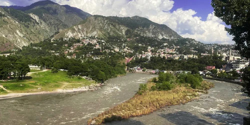
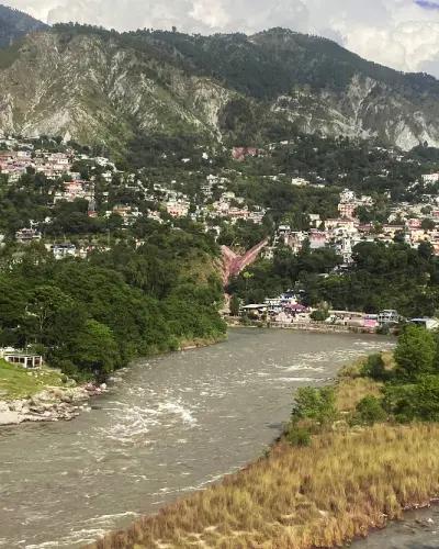
Muzaffarabad, located on the confluence of Jhelum River and Neelum River, is the capital of Azad Jammu and Kashmir, Pakistan. The splendid view of the confluence of the Jhelum and Neelum rivers at Domel attracts a number of visitors to enjoy the riversides. Its name was given due to Sultan Muzaffar Khan, leader of the Bomba tribe, who ruled Kashmir in 1646.
Kotli is the most populous district of Kashmir and is situated along the Poonch River at a distance of 136 km from Rawalpindi. From Motorway N5 near Rawat Fort, move on Kallar Syedan-Dadyal Road and finally turn left to join Kotli Road in Mirpur to access Kotli.
Bhimber, also known as Baab-e-Kashmir, is situated at the distance of 50 km from Mirpur on the border between Kashmir and Punjab. It was historically on the location on the route that was followed by the Mughals to visit the Kashmir Valley. It was got the status of district in 1996.
Rawalakot, known as Pearl Valley, is located in Azad Jammu and Kashmir in the Pir Panjal Range at the elevation of 5,374 feet having a distance of 120 km from Rawalpindi via Kahuta on the Rawalakot Road. It is also accessible from Abbottabad by Sudhan Gali Road, then turns right on the Bagh Highway, and finally move on Rawalakot Road at Arja.
Bagh is a mountainous and lush green area of Azad Kashmir in the Himalayas and Pir Panjal Range at an average elevation of between 1,500 to 2,500 meters above sea level. It is located at the distance of 88km from Muzaffarabad via Sudhan Gali on Sudhan Gali Road along the Mahl River with number of rivulets. These mountains are covered with coniferous forests. It was part of Poonch district before 1988, when it was given a status of district.
Haveli is a district in Azad Kashmir and is located on an elevation of 8,000 feet at the distance of 141 km from Muzaffarabad. It is accessible via Kohala through Bagh Highway and then following Dhulli Road. It is covered by Indian-Occupied Jammu & Kashmir from its three sides with the Baramulla district.