Visiting places in Gilgit Baltistan Pakistan
We provide an inclusive collections of high resolution pictures of Gilgit Baltistan and travel guide of famous and attractive visiting places in Gilgit Baltistan. Gilgit Baltistan Travel guide is also available to plan a tour for various visiting places there to spend the best and memorable moments of your life while exploring it.
-
Hunza
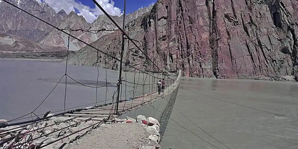
Hunza, a mountainous valley in Gilgit Baltistan, is situated at a distance of 98 km from Gilgit city. There are several high peaks above 20,000 feet in Hunza Valley and provides a splendid view of many high mountains such Rakaposhi (25,551 ft), Bojahagur Duanasir II (24,045 ft), Ghenta Sar (19, 980 ft), and Hunza Peak (20, 571 ft).
Visiting Locations in Hunza -
Ishkoman
Ishkoman valley is located in Ghizer district, Gilgit Baltistan, Pakistan, at a distance of 140 km from Gilgit City. It will be accessed on the right of Gahkuch along the Karamber River on Karambar River Valley Road. It is a high mountain valley surrounding by snow-capped peaks at an altitude from 7,000 to 12,000 feet in the Hindukush and Karakorum Range. The highest peak near Ishkoman is Shiniki peak, which can be visible from Ishkoman valley.
Visiting Locations in Ishkoman -
Jaglot
Jaglot is situated on the mouth of Sai Nallah in the Gilgit District at a distance of 45 km from Gilgit city on the Karakoram Highway. It is a very important town in Gilgit as it is a junction point of three main mountain ranges as well as confluence of the Gilgit River and the Indus River.
Visiting Locations in Jaglot -
Kachura Village
Kachura Village is the gateway to the twin lakes, Lower Kachura and Upper Kachura. It is a lush village with fruit orchards. From the main Gilgit-Skardu road, turn off on a trek shaded with lush fruit tree in the Kachura basin. There are several roadside trout fish farms, precious stone and gem shops, and wood carving stops.
Visiting Locations in Kachura Village -
Kalash Valleys
The Kalash Valley, surrounded by the Hindukush Range, is located in Chitral district, Pakistan, at the distance of 36km from Chitral main city on National Highway N-45. There are three valleys, Bumburet, Rumbur, and Birir. From Ayun village on N-45, turn right on Bamboret Valley Road access the Kalash Valley.
Visiting Locations in Kalash Valleys -
Karimabad
Karimabad, also known as Baltit, is the capital of Hunza Valley in Gilgit-Baltistan, located at the distance of 100 km from Gilgit main city on the west bank of the Hunza River. It is the best tourist spot in Pakistan especially Baltiti Fort and Karimabad village are the main attraction of this area.
Visiting Locations in Karimabad -
Ladyfinger Peak
Ladyfinger Peak is one the highest rock spire peak without snow. It is situated along the Hunza Peak on the southwest ridge of the Ultar Sar massif in Batura Muztagh and clearly visible from Hunza Valley.
Visiting Locations in Ladyfinger Peak -
Makuli Meadows
Makuli Meadows is another beautiful and lush green meadows among the snow-capped mountains. From the main Yasin Road, turn right along the Qorqolti Bar Nala near Shahman town after crossing Shuhda-e-Yasin tomb. Beginning part of the road is good for vehicle, then two hours trek is used to access the Makuli meadows. Most parts of the trek are full of lush green fields and fruit gardens. One can enjoy the magical sounds of Qorqolti Bar Nala along enjoying the fresh fruits from fruits on the trek.
Visiting Locations in Makuli Meadows -
Manthokha Waterfall
Manthokha Waterfall is located in Kharmang Valley in Madupur village in Gilgit-Baltistan at a distance of 40 km from Skardu city. It is one of the highest waterfalls in Pakistan, with a height of 180 feet on the vertical granite cliff face on an elevation of 7,648 feet.
Visiting Locations in Manthokha Waterfall -
Minawar
Minawar is located at 8 km from Gilgit City on Karakoram Highway after Chhamugarh in Gilgit District.
Visiting Locations in Minawar -
Minimarg
Minimarg is a very attractive village on an elevation of 2,845 meters in the Neelum Valley on the right bank of the Kishenganga River, also known as Neelum River. Geographically, it is located in Azad Kashmir, but it is mostly accessible from Astore Gilgit-Baltisan.
Visiting Locations in Minimarg -
Naltar valley
Naltar is a pine forest village in Gilgit at a distance of 40 km from Gilgit city. It is famous for its scenery and wildlife. Various animals can be seen while moving toward Naltar valley. Naltar is the second Ski Resort in Pakistan.
Visiting Locations in Naltar valley -
Nanga Parbat
Nanga Parbat, also known as Killer Mountain, is located on the border between Diamer and Astore districts. It is locally known as Diamer, King of the mountains. It is the 9th highest mountain in the world, having a height of 8,126 meters. It is the most difficult mountain to climb due to its vertical and dangerous structure. The weather conditions here, are too much uncertain, within few minutes, it covers with clouds and temperature drops below freezing point.
Visiting Locations in Nanga Parbat -
Naz Bar Nala
Naz Bar Nala trek is a fantastic hikking trek toward Naz Bar Pass and Yarkun Valley in the Chitral district. It is a jeep trek along the Naz Bar Nala and gives you one of more pictureous beauty along the stream moving two rows of mountains. From Thawoos on Yasin Road, turn left for it. Few kilometers of the trek is metallic road, then it is a totally jeep trek, otherwise it takes four to five hours by foot.
Visiting Locations in Naz Bar Nala -
Passu
Passu is a small village located on the Hunza River at an elevation of 8,117 feet at the distance of 150 km from Gilgit on the Karakoram Highway. It is one of the beautiful valley of Gojal Upper Hunza and famous for the magnificent and panoramic view of Passu Cones from the KKH.
Visiting Locations in Passu -
Phander Lake
Phander Lake is the largest and attractive lake in the Koh-i-Ghizer in Phander valley. It depicts charming colors which attract most of the tourists in Phander valley. It is also the main source of fresh water in Phander valley.
Visiting Locations in Phander Lake -
Phander Valley
Phander valley is located in Gupis-Yasin district in Gilgit-Baltistan at the distance of 184 KM from Gilgit. The valley is quite flat like a palm, that's why it is called Phander as meaning of Phan is palm in Khowar language, local language of the region.
Visiting Locations in Phander Valley -
Rahimabad
Rahimabad is a beautiful and attractive hill station in the Gilgit district in Gilgit Baltistan on the right bank of Hunza River. It is located at the distance of 33km from Gilgit city on the Karakoram Highway in very high mountainous region.
Visiting Locations in Rahimabad -
Raikot Glacier
Fairy Meadows plateau is a beautiful place at the top of the mountain in front of Nanga Parbat. This is Raikot Glacier from the Rakhiot Face of the Nanga Parbat. One have to cross this glacier to access the Base Camp to get the front view of the Nanga Parbat.
Visiting Locations in Raikot Glacier -
Rama Lake
Rama Lake is located at on elevation of 11,506 feet in Chongra village in the Astore District at a distance of 122km from Gilgit city. It is one of the most beautiful lakes in Pakistan with the lush green pastures and snow-covered peaks around it.
Visiting Locations in Rama Lake
About Gilgit Baltistan
Gilgit Baltistan is the fifth administrative part of Pakistan in its north side. Formaly it was part of Northern Areas, by the year 2009, it was granted limited autonomy under the Self-Governance Order of Government of Pakistan and renamed to Gilgit-Baltistan. Pakistan still not included it as a separate province due to Kashmir Movement in disputed Jammu and Kashmir held by India.
It has high mountainous landscape, it has five eight-thousanders peaks. It also has longest glaciers of the World outside the polar region.
There are number of rock carvings found in Gilgit-Baltistan in Passu village, which are the indications of human presence in 2000 BC. Bon and Buddhism were the first religions in this area. In 14th century, due to Sufi Muslim, Islam was introduced in Gilgit-Baltistan. In 1839, Gilgit-Baltistan was under the control of Sikhs and then after the First Anglo-Sikh War, it beame part of Jammu and Kashmir State in 1846. After First Kashmir War, Jammu and Kashmir State is divided among Pakistan and India by Line of Control by UN. After then, Gilgit-Baltistan is control by Federal Govenment of Pakistan as Northern Areas. By 2009, it was assigned a separate self-rule Gilgit-baltitan Legislative Assembly, so it became a de facto province without constitutionally part of Pakistan.
Gilgit-Baltistan is situated in the highest mountain ranges of the Karakoram, Himalayas and Hindukush. K2 and Nanga Parbat are one of the highest peaks in this area. The Biafo, the Baltoro, and the Batura Glaciers are the largest glaciers in this region. There are number of high altitude lakes such as Sheosar lake, Naltar lake, etc. The Deosai Plains are the second highest plateau in the world at the altitude of 14,500 feet.
The climate of Gilgit-Baltistan is depend upon the type of region, in some parts are hot in summers whereas others remained cool and pleasant in summers.