Visiting places in Gilgit Baltistan Pakistan
We provide an inclusive collections of high resolution pictures of Gilgit Baltistan and travel guide of famous and attractive visiting places in Gilgit Baltistan. Gilgit Baltistan Travel guide is also available to plan a tour for various visiting places there to spend the best and memorable moments of your life while exploring it.
-
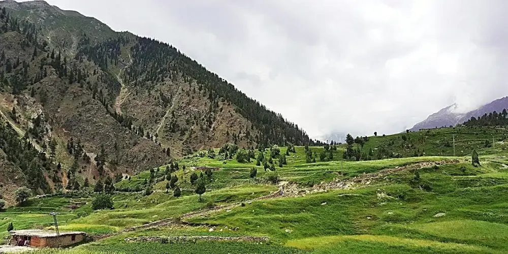
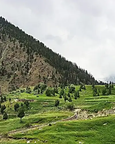
Rama Meadows
Rama Meadows is located at the distance of 13km from Rama Village in the Astore District. It is a peaceful and calm place to enjoy the greenery in the Rama Valley within the attractive mountain structures. The vast areas with lush forests makes oneself to forget the tiredness of the long traveling.
Visiting Locations in Rama Meadows -
Satpara Lake
Satpara Lake is one of the largest fresh water and natural lake located in Skardu at a distance of 8 km from the Skardu main town. A jeep can be hired from Skardu or you can enjoy the trek on foot. You can also enjoy trout fishing and boating there.
Visiting Locations in Satpara Lake -
Shandur Top
Shandur Top, flat plateau, is located in Ghizer district, Gilgit Baltistan, at an altitude of 12,200 feet at the distance of 212km from Gilgit via Shandur-Gilgit Road, or at the distance of 150km from Chitral via chital-Mastuj Road. It is surrounded by high altitude snow-capped mountains covered with snow all over the year. It is a major connection point between Gilgit-Baltistan and Khyber Pakhtoonkhwa.
Visiting Locations in Shandur Top -
Shangrila Lake
Shangrila Lake, also known as Kachura Lake, is located at an elevation of 8,200 feet in Kachura Village on a distance of 27 km from Skardu main. It is one of the most attractive and beautiful lakes in Pakistan. Its beauty becomes more charming due to the unique-styled red-roof restaurants and cottages around it.
Visiting Locations in Shangrila Lake -
Sheosar Lake
Sheosar Lake, also known as Blind lake, is located in Deosai National Park at an elevation of 13,589 feet. From the Astore district side, it is located at the distance of 16 km via Chillum Chowki. From the opposite side, it is at the distance of 65 km from Skardu main town. It is one of the highest alpine lakes in the World.
Visiting Locations in Sheosar Lake -
Shimshal
Shimshal is a largest village located in Hunza district in Gilgit-Baltistan on Pakistan China Border. It is the highest settlement in the Hunza district at the altitude of 10,170 feet above the sea level, and located at 210 KM from Gilgit City.
Visiting Locations in Shimshal -
Shukargah
Shukargah is one of the beautiful valleys in Gizer near Chatorkhand in Ishkoman Valley. Along the Hayool Gol, there broader and deeper valley with lush green meadows and streams. There is also a number of beautiful and attractive lakes in this area.
Visiting Locations in Shukargah -
Shukargah Lake
Shukargah Lake is a beautiful lake in Shukargah Valley in Ishkoman near Chatorkhand on Hayool Gol. It is a very attractive place for a peaceful, calm, and romantic environment. From Chatorkhand, you have to turn on right along the Hayool Gol to access the lake.
Visiting Locations in Shukargah Lake -
Sost
Sost is the last town in Gojal, Gilgit-Baltistan, Pakistan at the distance of 184 km from main Gilgit city on Karakoram Highway before China Border at Khunjerab Pass. It is the last town at an elevation of 2,800 meters inside Pakistan on the Karakoram Highway before the Chinese border.
Visiting Locations in Sost -
Ultar Sar Peak
Ultar Sur is located on the southeastern part of Batura Muztagh range of Karakoram. Hunza Peak and Ladyfinger Peak are located on southwest ridge of the Ultar Sar massif. It is located at the distance of 10 km from Karimabad.
Visiting Locations in Ultar Sar Peak -
Yasin River
The Yasin River flows throughout the Yasin Valley, orignated from the border between Chitral district and Gupis-Yasin district, from the glaciers of the Koyo Zom, that is the highest mountain in the Gupis-Yasin district. River flows from the narrow line between the mountains near Rawat and Darkut village, and then most of the areas in the Yasin Valley, it flows in wider channel. Finally it ends in the Gilgit River near Gupis town.
Visiting Locations in Yasin River -
Yasin Village
Yasin Village, a romance of beauty, is located in Yasin Valley in Gupis-Yasin district at the distance of 42 km from Gupis town in the region of Gilgit-Baltistan, Pakistan. It is surrounded by the high-altitude mountains of the Hindu Kush mountain range. It has an strategic importance due to having access to a high mountain pass toward the Yarkhun Valley and the Broghil Pass in the Upper Chitral district, which connect with the Wakhan Corridor in Afghanistan.
Visiting Locations in Yasin Village
About Gilgit Baltistan
Gilgit Baltistan is the fifth administrative part of Pakistan in its north side. Formaly it was part of Northern Areas, by the year 2009, it was granted limited autonomy under the Self-Governance Order of Government of Pakistan and renamed to Gilgit-Baltistan. Pakistan still not included it as a separate province due to Kashmir Movement in disputed Jammu and Kashmir held by India.
It has high mountainous landscape, it has five eight-thousanders peaks. It also has longest glaciers of the World outside the polar region.
There are number of rock carvings found in Gilgit-Baltistan in Passu village, which are the indications of human presence in 2000 BC. Bon and Buddhism were the first religions in this area. In 14th century, due to Sufi Muslim, Islam was introduced in Gilgit-Baltistan. In 1839, Gilgit-Baltistan was under the control of Sikhs and then after the First Anglo-Sikh War, it beame part of Jammu and Kashmir State in 1846. After First Kashmir War, Jammu and Kashmir State is divided among Pakistan and India by Line of Control by UN. After then, Gilgit-Baltistan is control by Federal Govenment of Pakistan as Northern Areas. By 2009, it was assigned a separate self-rule Gilgit-baltitan Legislative Assembly, so it became a de facto province without constitutionally part of Pakistan.
Gilgit-Baltistan is situated in the highest mountain ranges of the Karakoram, Himalayas and Hindukush. K2 and Nanga Parbat are one of the highest peaks in this area. The Biafo, the Baltoro, and the Batura Glaciers are the largest glaciers in this region. There are number of high altitude lakes such as Sheosar lake, Naltar lake, etc. The Deosai Plains are the second highest plateau in the world at the altitude of 14,500 feet.
The climate of Gilgit-Baltistan is depend upon the type of region, in some parts are hot in summers whereas others remained cool and pleasant in summers.