Hilly Areas in Pakistan
Hilly areas in Pakistan is normally composed of number of famous and World's highest mountain peaks. These mountainous valleys are part of famous mountain ranges such as Karakorum, Himalayas, and Hindukush ranges. Due to varying height above the sea level, the weather and temperature normally varies in these mountain and hilly areas. The landscape and structure of the hilly area depicts variety of beautiful and panoramic views that would never be forgotten from your memory. Some of these hilly areas also receive snowfall in winter season which attract number of visitors from all over the World.
Hilly areas which received snowfall in winter are normally known as hill station and there are several famous hill stations in Pakistan. Weather conditions of these hill stations are normally pleasant in the summer season. The mountains with snow around the hill station make it more attractive for tourists These hill stations are the most frequent visiting places specially for family tours.
Here, you explore different Hilly Areas in Pakistan with complete travel guides, location maps, and an inclusive collections of photo galleries of these Hilly Areas.
Main Categories
Sub Categories: Glaciers | Hill Stations | Mountain Passes | Mountain Peaks | Mountainous valleys
-
Nagar
Nagar district is located next to the Gilgit district in Gilgit Baltistan at an altitude of 8,822 feet on the Karakoram Highway. It was part of the Nagar-Hunza district, it is constituted as a separate district in July 2015. Nagar Khas is the major town and administrative headquarter of the Nagar district.
Visiting Locations in Nagar -
Naltar valley
Naltar is a pine forest village in Gilgit at a distance of 40 km from Gilgit city. It is famous for its scenery and wildlife. Various animals can be seen while moving toward Naltar valley. Naltar is the second Ski Resort in Pakistan.
Visiting Locations in Naltar valley -
Nanga Parbat
Nanga Parbat, also known as Killer Mountain, is located on the border between Diamer and Astore districts. It is locally known as Diamer, King of the mountains. It is the 9th highest mountain in the world, having a height of 8,126 meters. It is the most difficult mountain to climb due to its vertical and dangerous structure. The weather conditions here, are too much uncertain, within few minutes, it covers with clouds and temperature drops below freezing point.
Visiting Locations in Nanga Parbat -
Naran
Naran is a very attractive and pleasant hill station, located in Kaghan valley at the distance of 119 km from Mansehra at the altitude of 8,202 feet. It is most beautiful and scenic location in Pakistan and loving place for trekkers, hikers, and tourists from all over the Pakistan, even from foreign countries.
Visiting Locations in Naran -
Nathia Gali
Nathia Gali is the highest point and hill station in the Galyat area in Abbottabad, and is located at the distance of 82 km from Islamabad via Kashmir Road via Murree. It is fully covered with shades of pine, cedar, walnut, maple, and oak trees. It is popular for its scenic beauty with lush green meadow and forests. Mukshpuri and Miranjani are the two highest peaks of the area, you can also enjoy the trek, with some hiking, to the top of these hills.
Visiting Locations in Nathia Gali -
Neelum Valley
Neelum Valley, a bow-shaped thickly forested region, is the last district of Azad Jammu and Kashmir in Pakistan, located at the distance of 100km from Muzzafarabad at an altitude of 5,299 feet. Its name is due to the Neelum River, flowing across the valley. Valley is divided among Pakistan and Indian held Kashmir, the LOC is normally moved along the Neelum River in this valley.
Visiting Locations in Neelum Valley -
North Waziristan Agency
North Waziristan Agency is the mountainous area along the border between Afghanistan and Pakistan and lies on the North side of the Kurram River. It was the largest agency under the control of the Federally Administered Tribal Areas, FATA, before the merger with Khyber Pakhtoonkhwa. It is located at the distance of 278 km from Peshawar and accessible via Indus Highway.
Visiting Locations in North Waziristan Agency -
Passu
Passu is a small village located on the Hunza River at the distance of 150 km from Gilgit on the Karakoram Highway next to Gulmit in Gojal on the edge of the Passue Glacier and the Batura Glasier. Passu Cathedral, also known as Passu Cones, at an altitude of 20,033 feet, provides very attractive view for tourists from the Karakoram Highway. The Cathedral Ridge has beautiful view just from the Karakoram Highway near Passu village.
Visiting Locations in Passu -
Passu Cathedral
Passu Cathedral, also known as the Tupopdan Peaks or Passu Cones, is located at the altitude of 20,033 feet in Passu village on Karakoram Highway near the Hunza River. It is the most beautiful picturesque peak in Gilgit-Baltistan. It is worth staying here to get the beauty of this town in the high mountains before moving toward the Khunjerab Pass.
Visiting Locations in Passu Cathedral -
Peshawar
Peshawar, the Capital of Khyber Pakhtoonkhwa, is located on the eastern end of Khyber Pass surrounded by different mountain ranges on three sides, at the distance of 160 km from Islamabad on Islamabad-Peshawar Motorway M-1. It is the most important and largest city in Khybeer Pakhtoonkhwa.
Visiting Locations in Peshawar -
Phander Valley
Phander valley is located in Gupis-Yasin district in Gilgit-Baltistan at the distance of 184 KM from Gilgit on Gilgit Shandoor Road. The valley is quite flat like a palm, that's why it is called Phander as meaning of Phan is palm in Khowar language that is local language of the town.
Visiting Locations in Phander Valley -
Pir Chinsai
Pir Chinasi is a beautiful tourist spot situated in Muzaffarabad at the distance of 30 km on the top of hills at an altitude of 9,500 feet. There is a shire of a famous saint, Pir Hussain Shah Bukhari, on the top of the hill, that's why its name called as Pir Chinasi.
Visiting Locations in Pir Chinsai -
Pir Sohawa
Pir Sohawa is a hill station in the Margalla Hills at the distance of 17 km from Islamabad, have an elevation of 5,000 feet in Monal village which is part of Haripur District. It is the highest point in the Margalla Hills and may receive snowfalls in the winter season.
Visiting Locations in Pir Sohawa -
Pishin Valley
Pishin district is located at a distance of 50 km from Quetta in the northwest of Balochistan near the Afghanistan border, a real beautiful valley as consist of thousands of gardens full of fruits and flowers. It is the good source of crops, fruits and vegetables.
Visiting Locations in Pishin Valley -
Prospect Point Ziarat
Prospect Point is located 6km from Ziarat city at an altitude of 2,713 meters, which gives a splendid view of Koshki Valley. It is on the hill surrounded by Ziarat city. At the top of the hill, you will get a beautiful view of the valley sloping downside.
Visiting Locations in Prospect Point Ziarat -
Quetta
Quetta, also known as the fruit garden of Pakistan, is the capital of Balochistan province, located at a distance of 691 km from Karachi. There is a number of fruit orchards in and around the city, and there are large and different varieties of fruits and dry fruits produced there.
Visiting Locations in Quetta -
Rahimabad
Rahimabad is a beautiful and attractive hill station in the Gilgit district in Gilgit Baltistan on the right bank of Hunza River. It is located at the distance of 33km from Gilgit city on the Karakoram Highway in very high mountainous region. It is a lush green valley along the Hunza River and has a very pleasant atmosphere.
Visiting Locations in Rahimabad -
Raikot Glacier
Fairy Meadows plateau is a beautiful place at the top of the mountain in front of Nanga Parbat. This is Raikot Glacier from the Rakhiot Face of the Nanga Parbat. One have to cross this glacier to access the Base Camp to get the front view of the Nanga Parbat.
Visiting Locations in Raikot Glacier -
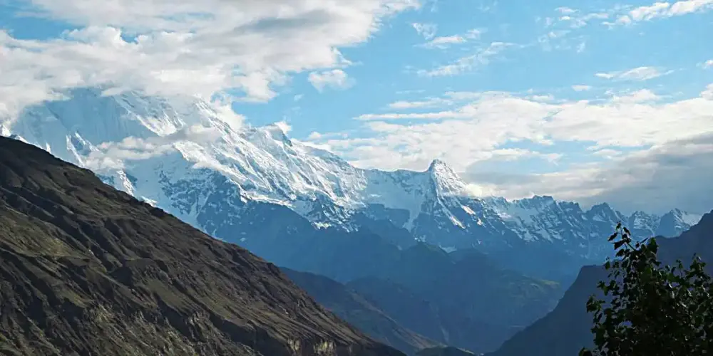
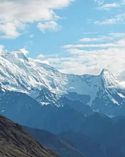
Rakaposhi
Rakaposhi, also known as Dumani, is situated in the Karakoram Range and is located in the center of Nagar Valley. It is the 12th highest peak in Pakistan at an elevation of 25,551 feet and one of the world's most beautiful peaks. It gives an exceptional view from the Hunza valley on the Karakorum Highway.
Visiting Locations in Rakaposhi -
Rawalakot
Rawalakot, known as Pearl Valley, is located in Azad Jammu and Kashmir in the Pir Panjal Range at the elevation of 5,374 feet having a distance of 120 km from Rawalpindi via Kahuta on the Rawalakot Road. It is also accessible from Abbottabad by Sudhan Gali Road, then turns right on the Bagh Highway, and finally move on Rawalakot Road at Arja.
Visiting Locations in Rawalakot -
Rondu
Rondu district is part of Gilgit-Baltistan and was given the status of district in 2019. Before that, it was part of the Skardu district. It is composed of the Rondu valley only which is the fourth largest valley in Gilgit-Baltistan. Bambudas is the headquarters of the Rondu district.
Visiting Locations in Rondu -
Shaban Valley
Shaban is an attractive tourist point at the distance of 35 km from Quetta. It is full of green orchards of apples and other fruits. Travelling toward Shaban valley is not easy on non-metallic and damaged road, but one loves its natural beauty.
Visiting Locations in Shaban Valley -
Shakarparian Hills
Shakarparian Hills is a beautiful and charming place in Islamabad at a distance of 5km from Zero Point Islamabad in the Potohar Range. There is a hill in the park, which is the main attraction of the park. From that hill, one can have a bird\'s eye view of both cities Islamabad and Rawalpindi. It is the best location for a day relaxing with family or friends.
Visiting Locations in Shakarparian Hills -
Shandur Top
Shandur Top, flat plateau, is located in Ghizer district, Gilgit Baltistan, at an altitude of 12,200 feet at the distance of 212km from Gilgit via Shandur-Gilgit Road, or at the distance of 150km from Chitral via chital-Mastuj Road. It is surrounded by high altitude snow-capped mountains covered with snow all over the year. It is a major connection point between Gilgit-Baltistan and Khyber Pakhtoonkhwa.
Visiting Locations in Shandur Top